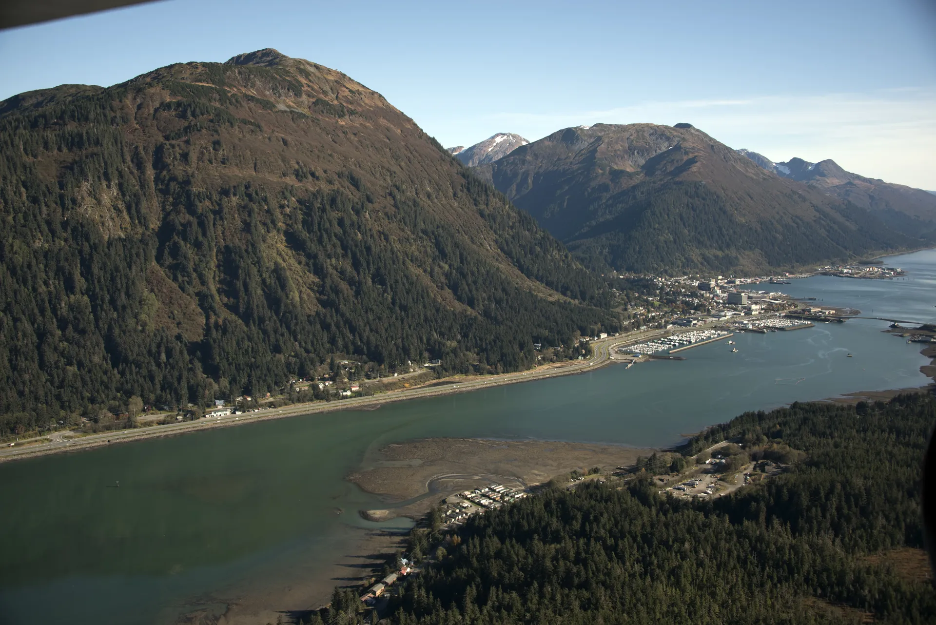
Juneau’s most useful orientation fact is not a list of attractions. It is compression. Gastineau Channel, Douglas Island, downtown streets, civic institutions, working docks, forested slopes, and routes toward the Juneau Icefield occupy a remarkably tight coastal field. The city has no road connection to the rest of North America, yet it is not remote in the sense of being empty: it is Alaska’s capital and a year-round community with museums, government, arts, schools, harbors, homes, restaurants, trails, and public services.
This guide treats Juneau as several connected systems rather than one postcard. It does not provide live weather, trail status, schedules, prices, availability, or operator advice. Use it to form better questions, then confirm time-sensitive details with the responsible agency or provider.
1. Begin with the Channel Ledger
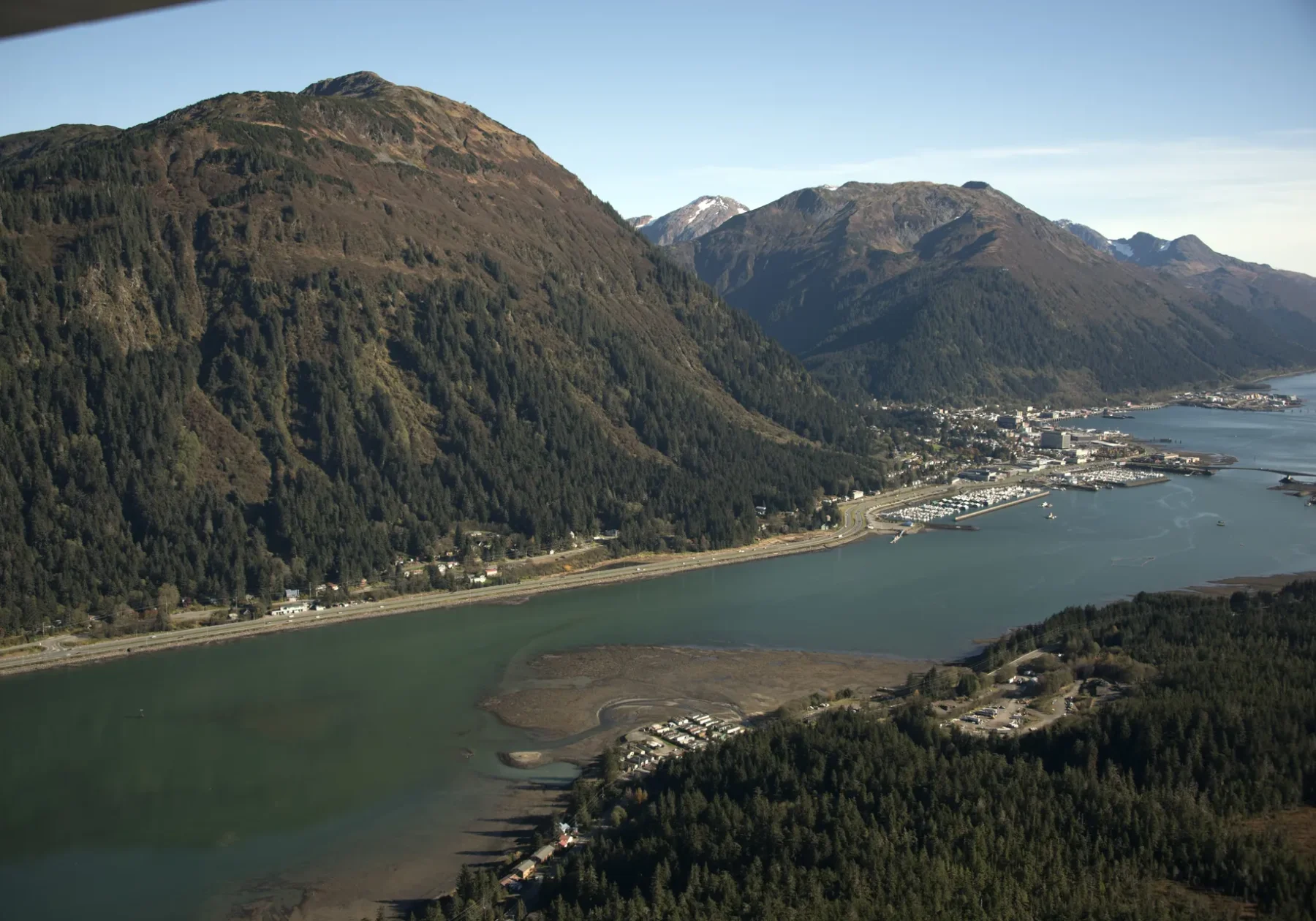
Imagine a ledger divided by a broad water gutter. On the mainland side, downtown rises from the port into a narrow street grid pressed against Mount Juneau and Mount Roberts. Across the channel, Douglas Island provides an answering shore, neighborhoods, trail access, and the Treadwell landscape. The bridge joins those sides, but the water still shapes direction, light, wind, views, and the way places feel.
The channel is not a decorative wave. It is working water. Harbors, cruise berths, small boats, floatplanes, tides, wakes, weather, and public infrastructure share the same corridor. When you look at a map or photograph, keep three layers in view:
- Lower reference: dock edge, seawalk, street, bridge, shoreline, or harbor.
- Built middle distance: civic buildings, homes, commercial streets, port systems, and neighborhood fabric.
- Immediate rise: forest, rock, cloud, snow, or a trail route climbing out of the compressed strip.
This layered reading prevents two common mistakes: treating downtown as a stage set for visitors, and treating the mountains as a generic backdrop with no relationship to the city below.
2. Juneau is a capital in active use
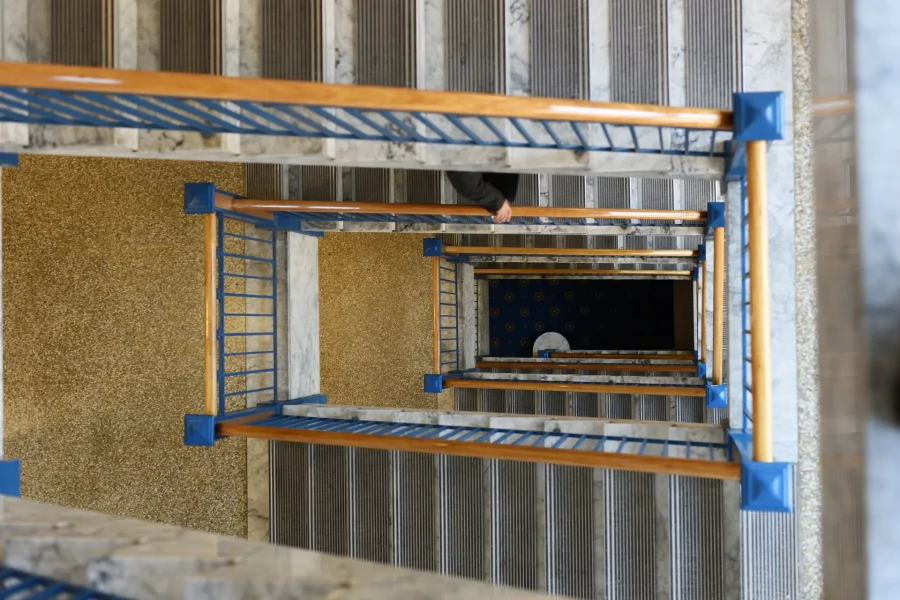
The Capitol, state offices, public library, museums, arts venues, schools, streets, and gathering spaces are not theme-park scenery. They carry ordinary civic work. A useful downtown walk therefore pays attention to doors, stairs, public interiors, street grades, signs, transit stops, rain protection, lunch-hour movement, and how residents move between waterfront and hillside.
The Alaska State Museum and other public institutions can provide context that a quick viewpoint cannot. Native-led institutions, including Sealaska Heritage Institute, place Lingít, Haida, and Tsimshian cultural work in present-tense institutional and artist-led settings. Visitors should follow the institution’s own guidance about photography, exhibitions, public art, and attribution.
Cultural visibility is not a license to copy. Named artwork, language, clan property, regalia, ceremony, and formline remain culturally and legally specific.
Tourism Juneau does not turn ovoids, clan crests, basketry, totem silhouettes, or commissioned art into a house pattern. The right approach is to learn from Native-led interpretation, credit named creators, respect photography rules, and leave cultural authorship intact.
3. Read downtown vertically, not only block by block
Downtown’s plan is compact, but elevation changes how short distances feel. A destination may appear close in plan view while stairs, grade, rain, snow, curb conditions, or a route crossing add effort. Look uphill and downhill as often as you look along a street. The end of a block may reveal channel, bridge, port, or steep forest, making the city’s narrowness visible.
A simple walking sequence can be organized around conditions rather than a fixed attraction checklist:
- Start at a lower waterfront reference and note current port activity.
- Move into the civic grid and identify one public institution whose hours and access you have confirmed.
- Use a stair or uphill street only if surface, weather, footwear, and mobility make sense.
- Pause at an across-channel view to restore geographic scale.
- Return by a different street so rain shelter, crossings, and building use become part of the reading.
This sequence is deliberately flexible. It can shrink to a few blocks or expand, and it does not require pretending that every visitor moves at the same speed.

Mendenhall Glacier Ice Adventure Tour
Explore Mendenhall Glacier on this exclusive adventure tour into the Alaskan Wilderness. Your expert guides will lea...

Taku Lodge Feast & 5-Glacier Seaplane Discovery
Leave behind the hustle and bustle of Downtown Juneau as you depart the waters with Wings Airways en route to the Ju...

Juneau Small Group Sea Kayaking with Mendenhall Glacier Views
Explore Juneau’s incredible coastline on this small-group kayaking adventure through the beautiful Mendenhall Wetl...
4. Douglas is across the water, not a background panel
Douglas Island is a living part of the borough with its own neighborhoods, shorelines, slopes, and histories. From downtown it can look close enough to flatten into a scenic wall. Crossing the bridge changes that impression. The city becomes the view across the channel, and the mainland’s compressed strip reads more clearly.
The Treadwell area requires care. Industrial remnants and forest succession can be read together without romanticizing extraction or treating ruins as an adventure prop. Use public interpretation and maintained access, recognize that mining history is only one layer of a much longer Indigenous and environmental history, and do not enter closed or unstable structures.
When comparing downtown and Douglas, ask what changes:
- Which shore is foreground and which becomes context?
- How do travel time and the bridge affect a short day?
- Does the visit require a vehicle, transit, a safe walking route, or another current transport plan?
- What public access and surface conditions have been confirmed?
5. Auke Bay and “out the road” open the scale
Downtown’s compression is not the whole borough. Moving toward Auke Bay and farther along the road system changes horizon, harbor scale, forest access, and travel time. Small-boat infrastructure, coves, parks, trailheads, residential areas, and university or research activity can replace the capital-core rhythm.
This is why “near Juneau” is not a sufficient planning phrase. A location may be within the borough yet require meaningful travel time from downtown. Confirm the actual start point, meeting point, transport, return plan, and margin around any timed activity. A cruise berth, downtown hotel, Valley address, Auke Bay marina, and out-the-road trailhead are not interchangeable origins.
Marine wildlife experiences also require provider truth and respectful distance. Do not infer a guaranteed species, behavior, or sighting from a photograph. Use operator and agency information, keep expectations conditional, and treat wildlife as part of an ecosystem rather than a scheduled performance.
6. The Tongass is weather, surface, and living forest
Temperate rainforest is not merely a deep-green photograph. It is moisture, shade, roots, boardwalk, mud, rock, drainage, changing streams, fallen material, and rapidly shifting light. A trail that seems simple by distance may feel different in rain, on wet roots, at dusk, or when visibility changes.
Build a trail decision in layers:
- Current authority: check the land manager or responsible local source for access, closures, advisories, and route description.
- Match each advisory to the exact trail, segment, and date you intend to use.
- Keep official access and closure guidance distinct from provider meeting instructions.
- Surface and exposure: identify mud, roots, rock, bridges, stairs, steepness, water crossings, shore exposure, or avalanche terrain where relevant.
- Weather margin: use current forecasts and recognize that cloud, wind, rain, and temperature can vary across the borough.
- Turnaround rule: choose a time or condition that ends the outing before fatigue or fading light makes the decision for you.
- Stewardship: stay on durable or designated surfaces, pack out waste, respect closures, and avoid expanding muddy edges.
Essential items depend on the route and season, but a general decision checklist includes layers that work when damp, a rain shell, suitable footwear, water, food, navigation appropriate to the route, and enough reserve to wait or turn back. This list is not a substitute for route-specific guidance.
Still comparing Channel Icefield: Civic Wild Field?
Ask for tour ideas, hotel suggestions, or a simple trip plan that combines both.
Trip Helper
7. Mendenhall is one outlet of a changing icefield
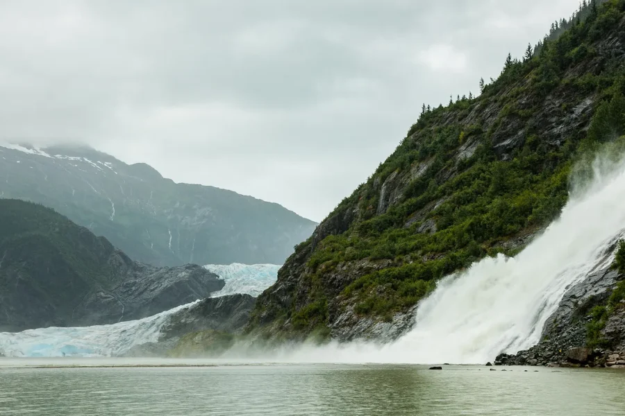
Mendenhall is often used as shorthand for Juneau’s glacier landscape. The U.S. Forest Service places it within a much larger Juneau Icefield system and discusses continuing change. A present-tense view may include proglacial lake, exposed rock, waterfall, forest succession, sediment, and a glacier position that differs from older photographs.
Do not plan around an undated image. Use current official information for access, facilities, routes, hazards, and the view that exists now. Avoid describing glacial ice as timeless or promising a particular color, cave, proximity, wildlife encounter, or dramatic condition.
Ice Signal: The most specific photograph may show relationships—lake to rock, forest to newly exposed ground, waterfall to valley scale—rather than an isolated saturated-blue close-up.
A thoughtful visit also recognizes physical limits. Stay behind barriers, follow closures, do not approach unstable ice or water edges, and understand that a trail or viewpoint name does not guarantee a safe condition on a particular day.
8. Compare route systems before filling time
Juneau planning improves when the day is organized by geography and transport rather than the maximum number of products. The following table is a planning frame, not a promise of current service:
| Area or system | Useful question | Common planning variable |
|---|---|---|
| Downtown civic core | Which public interior or institution provides context? | Hours, grade, walking surface, port activity |
| Douglas Island | What changes when Juneau becomes the across-channel view? | Bridge crossing, transport, public access |
| Valley and Mendenhall | What does the current changing landscape show? | Access, transport, current conditions, time margin |
| Auke Bay | Is the day about working harbor, marine access, or a quieter base? | Meeting point, distance from downtown, return plan |
| Trails and rainforest | Does the route match the weather, surface, and group? | Advisories, footwear, light, turnaround rule |
If two activities occupy different systems, account for the transition between them. Do not assume “Juneau pickup” means every address or berth. Provider-supplied times and meeting instructions should be read as exact operational details, then confirmed before purchase or departure.
9. Use provider facts without giving them the whole story
The Tours page can show provider-supplied products, photos, ratings, prices, availability, and booking links. Those facts are useful but do not replace geographic context. Before choosing, identify where the experience starts, what landscape or civic system it enters, how much transition time it needs, and which claims belong to the provider.
Never infer a discount, review, duration, accessibility feature, wildlife encounter, or cancellation right from generic destination copy. Read the actual product record and final checkout terms. If a product fact conflicts with an official closure or public-safety instruction, the responsible authority takes priority.
10. Choose a base by friction, not by a generic “best” list
A Juneau base changes how much of the day is spent transitioning. Downtown may support a compact civic and waterfront rhythm. Douglas changes the across-channel relationship. Valley areas can alter access to some routes. Auke Bay may suit a harbor-oriented plan while increasing distance from downtown. The right answer depends on the actual itinerary, not a universal ranking.
Before live lodging inventory is configured, use the Where to Stay guide to ask:
- Which location will be used at the beginning and end of most days?
- What transport is realistically available at the required time?
- Does the group need a low-grade walk, parking, kitchen, quiet evening, or proximity to a specific meeting point?
- How much weather margin is needed between the base and a timed departure?
When provider-owned inventory arrives, compare those practical needs with current terms and availability rather than letting a photograph choose the area.

5-Glacier Seaplane Exploration
The grandeur of Alaska's epic glaciers will thrill and delight you on Juneau's only FIVE glacier flightseeing tour...

Mendenhall Lake Canoe Adventure
Paddle across Mendenhall Lake, navigating past icebergs, surrounded by Alaskan wildlife on an exceptionally stable...

Juneau Private Sightseeing and Hatchery with a Local (Luxury SUV)
Enjoy the intimacy of just your family and friends — up to 5 — on a private sightseeing tour of gorgeous Juneau...
11. Keep cultural and photographic choices accountable
A field guide can create harm by making a real culture, resident, or workplace into texture. Photograph people with permission and context. Credit the creator of public art. Follow museum and cultural-institution rules. Do not use ceremonial imagery as a generic hero, crop a crest into a decorative fragment, or describe contemporary Native culture only in the past tense.
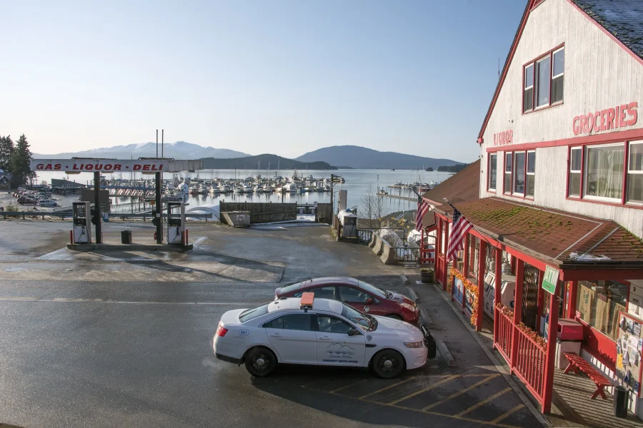
The same discipline applies to working spaces. A dock, fishing vessel, floatplane, public office, or residential street is not automatically a visitor set. Stay within public access, avoid obstructing work, and keep operator logos or private information out of site-owned imagery unless their use is authorized.
12. Let weather change the sequence
Juneau’s rain and cloud are not failures of the destination. They change visibility, reflections, sound, surface, and what scale of activity makes sense. A low-cloud day may make close civic, museum, food, harbor-detail, or rainforest experiences more legible than a distant viewpoint. A clearer window may support a broader channel or mountain reading.
Maintain an indoor, compact, or lower-exposure alternative rather than forcing a plan built for different conditions. The point is not to predict weather perfectly; it is to preserve choices.
13. A practical two-column check
Before leaving the base, review both columns:
Place
- Exact start and end location
- Current access source
- Surface and elevation
- Cultural or workplace context
- Public versus private space
Time
- Transport and transition margin
- Weather and light
- Provider check-in details
- Turnaround rule
- Return route and reserve
14. Leave the ledger open
A complete Juneau day does not need to contain every system. One well-read civic institution, a channel crossing, a forest walk, or a changing-ice perspective can be enough. The Channel Ledger is useful precisely because it keeps relationships visible without demanding that every box be checked.

eBike Rainforest Experience
After a 9 mile narrated van ride to the north end of Douglas Island and a short training session, guests start e-bik...

Juneau Underground Gold Mine and Panning Experience
This experience takes you to the only underground GOLD mine tour in the state of Alaska. Underground Juneau Gold is...

Juneau Private 3 Hour Scenic Road Trip
We offer the only tour of the Juneau Road system. Juneau has the largest land mass of all capital cities in America...
Return to Guides to choose a focused question, then confirm live conditions with the responsible source. Juneau is most specific when capital, community, channel, forest, and icefield remain connected—but not collapsed into one generic Alaska image.